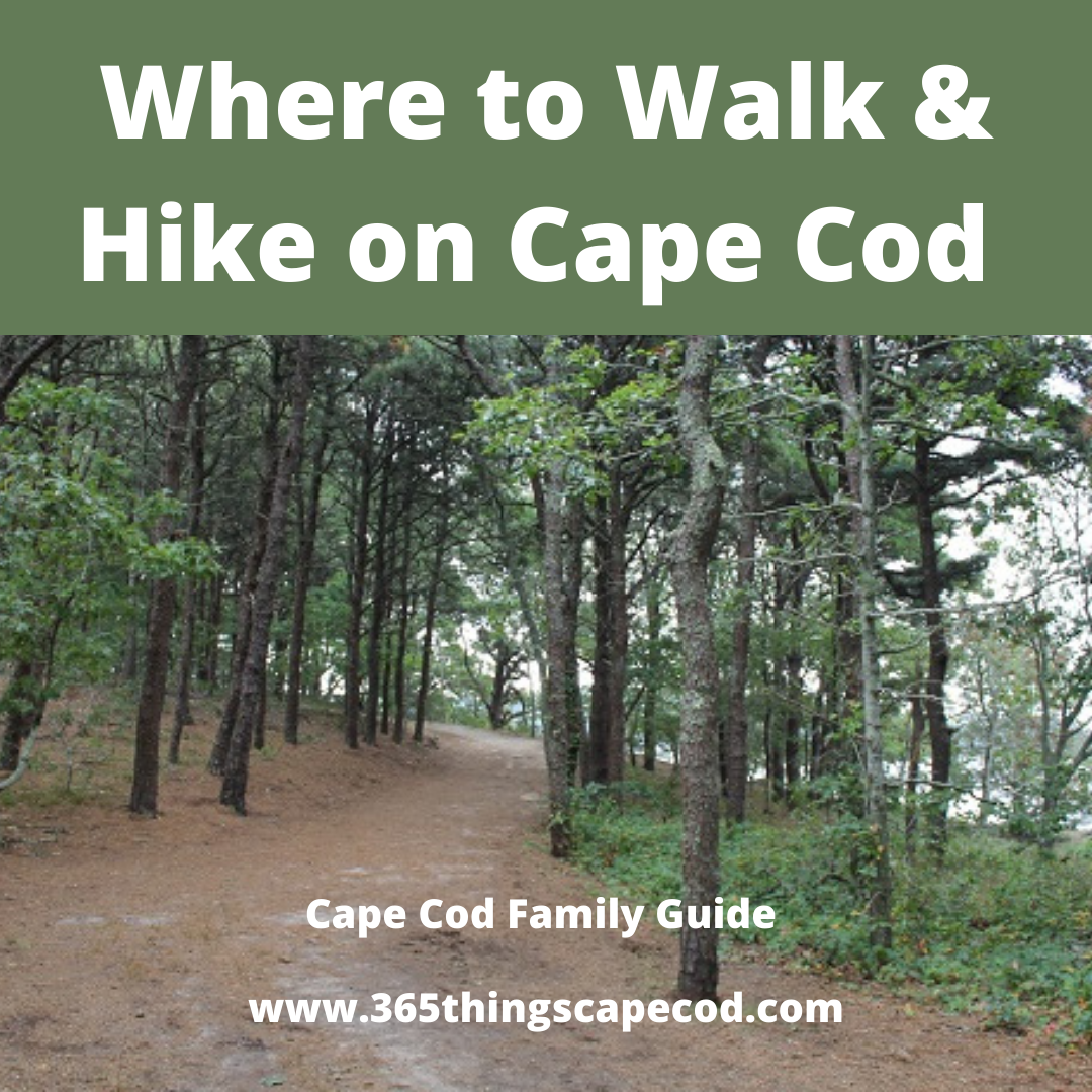
Where to Walk & Hike on Cape Cod 2026
Are you look to take a walk or hike with the family Cape Cod’s breathtaking terrain extends well past the beach, with scenic trails just steps away in every direction, each one as distinctly unique as the regions of the Cape themselves. You don’t have to go far to find a walk that takes you a world away.
Barnstable Walking and Hiking Trials
Meetinghouse Farm: 23 acres of town-owned land await your pleasure in West Barnstable. Twenty-three acres divided into outdoor rooms such as a holly grove with a new butterfly garden; vegetable plots for families and another that grows produce for the Noah Shelter; the biggest white birch trees you ever saw; and a hilly trail thickly planted with rhododendrons.
Sandy Neck Recreation Area Sandy Neck Nature Trail is a 7.5 mile moderately trafficked loop trail located near Barnstable, Massachusetts that features beautiful wild flowers and is rated as moderate. The trail offers a number of activity options and is accessible year-round. Dogs are also able to use this trail.
Long Pasture Wildlife Sanctuary Walking trails traverse this scenic harborside wildlife refuge with beaches, meadows & woodlands.
Explore 2.5 miles of trails at Long Pasture Wildlife Sanctuary in Barnstable. Gentle woodland and meadow walking trails lead to a view of Barnstable Harbor flanked by the dunes of Sandy Neck Barrier Beach. Look for groves of tupelo, red maple, holly, and large oak trees along the trail.
Marsh Boardwalk
This short boardwalk provides access into a slice of the Barnstable Great Marsh, Cape Cod’s largest salt marsh and most biologically diverse habitat. Learn about salt marsh ecology through our interpretive graphics. Tide permitting, explore the vast sanctuary tidal flats and find horseshoe crabs, moon snails, and hermit crabs. The secluded Long Pasture Beach offers opportunities to swim, sunbathe, and enjoy the spectacular views of Sandy Neck Barrier Beach.
Harbor Overlook Trail
From the Boardwalk follow the trailhead west to Night Heron Pond where the ponds namesake as well as Green Herons, Snowy Egrets, and kingfishers can be spotted.
Beck Family Trail and Restored Wetlands
Along the Beck Family Trail, you will discover 6 newly restored vernal pools (wetlands) scattered along the field edges. These vernal pools were built to meet the specific habitat needs of rare species including the Eastern Spadefoot Toad, American Woodcock, Eastern Box Turtle, and a host of avian and insect pollinators and their associated flowering plants. You may notice how the restored wetlands change in appearance over time as plants and animals colonize the new habitats.
Bone Hill Trail
The open fields surrounding this trail are the best spots to observe many species of butterflies, dragonflies, and the fantastic fall foliage of tupelo trees.
Woodcock Trail
This trail loops through early successional habitat perfect for the American Woodcock. From here access the Beck Family Trail for a longer loop.
Butterfly Mosaic Trail
This 1/4-mile trail through the open fields takes you through a series of 10 native wildflower plots that attract up to 30 species of butterflies.
Tamarack Park & Long Pond Conservation Area There is a small dirt trail out of the back of Tamarack Park’s meadow, which meanders through a small grove where volunteers have planted a variety of young trees. This section of the park is notable for its lovely glimpses of the Long Pond marshes through the trees. To access the shoreline launch into Long Pond Conservation Area, walk down the paved path on the far (southwest) end of the paved circular driveway.
Crocker Neck Conservation Area A total of 1.5 miles of walking trails are maintained on Crocker Neck. A leisurely stroll of the property takes less than one hour, but more time is recommended to soak in the rich tapestry of life to be found. Parking space is provided at the northern gate on Santuit Road and inside The Lane.
Hathaway’s Pond Loop is a 1.4 mile loop trail located near Barnstable, Massachusetts that features a lake and is good for all skill levels. The trail is primarily used for hiking, walking, running, and nature trips. Dog friendly path
Otis Atwood Conservation Area A 1.6-mile rolling singletrack trail off Osterville-West Barnstable Road.
Trail of Tears The Trail of Tears is a 1200 acre parcel of conservation land in the village of West Barnstable. The main recreation focus is multi-use and revolves around mt.biking, hiking, trail running and cross country skiing. Hunting is allowed in season.
West Barnstable Conservation Area is comprised of 1,114 acres and is Barnstable’s largest conservation area.
Whelan Conservation Area: The Sandplain Grassland Trail is a half mile loop of easy walking through a changing landscape which reflects the ongoing effects of both natural succession and human habitation. It is a stitchwork of open fields, grassland, orchards and young woodland exhibiting a mix of native and introduced plant species.
Bourne Walking and Hiking Trails
Bourne Sisters Woodland The Bourne Sisters Woodland consists of 22 acres of woodland slopes and valleys bordered by a brook, millpond and cranberry bogs. A loop trail, bisected by several cross trails, provides walkers with interesting vistas.
The property is located 8/10ths of a mile North of the intersection of Clay Pond/Beach St. on County Rd, just South of Brookside Estates. Parking is available at the BCT signed area on the East side of County Rd. and across at the Town of Bourne Leary Property.
Bournedale Hills Trail The Bournedale Hills Trail extends 1.4 miles along the north side of the Canal from Bourne Scenic Park to the Herring Run. The trail includes a .8 mile self guided loop which interprets the Canal’s historic and natural features.
Broyer Conservation Area 12 acres of pine and mixed hardwoods, owned by the Town of Bourne and maintained by the BCT. Parking is available along the west side of Depot Road near the trailheads.
DeNormandie Woods Conservation Area DeNormandie Woods is located in the heart of Cataumet. It was the first piece of land acquired by the BCT, donated in 1980 by Philip DeNormandie and Tina Rathborne.
Four Ponds Conservation Area Located entirely in the town of Pocasset on Cape Cod.
Lawrence Island beaches 7 acres of wooded uplands and sandy beaches. Parking is along Grasslands Lane with access to the island along the shoreline below the high tide mark.
Little Bay Park and Monks Park Over 1 mile of trails on 29 ac.of Bourne Conservation Trust and Town owned land that has a waterfront area and beautiful views. Parking on Shore Road and Valley Bars Road.
Nickerson Conservation Area Eight acres of woodland on the Cape Cod Canal. Parking is available at the entrance to Aptucxet Trading Post. A short access trail leads to a loop trail and connecting trail to the Cape Cod Canal bike and walking path.
Red Brook Pond Conservation Area 1.2 miles through pitch pine woods and cranberry bogs. Entrance is at Thaxter Road.
Robinson Conservation Area:This 29 acres consists of 18 acres owned by the Town of Bourne and maintained by the BCT and 11 acres purchased in 10998 from Tom Kingman and member donations. The trail winds through mixed hardwoods, pine, spruce, uplands and wetlands. Parking is available at Cataumet Depot or Dimmick Waterfront
Brewster Walking and Hiking Trails
Boot Swamp Trail A section of the Punkhorn Parklands beginning at the end of paved Run Hill Road.
Calf Field Pond Trails The rail system passes through beech groves and by hole where large granite boulders were quarried in centuries past. The 2.5 mile outer loop includes inner loops for shorter walks.
Eagle Point 1.31 miles walking path starting from the access point at Upper Mill Pond. There are several loop trails that include bluffs overlooking Mill Pond, and a view of an old cranberry bog.
Eddy Bay Trail One mile path starting from Lower Road leading past 1870’s barn and house foundations, through a grove of holly trees, and then pine and oak woodland.
Eddy Sisters Trail: Half mile path following a maple swamp, upland forest, dikes of old cranberry bogs and farm fields from the 18th and 19th centuries.
John and Kristi Hay Trail This trail winds through pine-oak forest. A segment of the trail follows an ancient road which was once the connection between Stony Brook Valley 18th century factory village and Wings Island.
John Wing Trail 1.3 miles of the Cape Cod Bay
Lee Baldwin Trail A one mile path honoring Lee Baldwin, a native Cape Cod naturalist. The trail crosses the Stony Brook marsh and extends to upland groves of beech trees.
Nickerson State Park Eight miles of roads, hiking trails, an eight mile bike path that connects to the 22 mile Cape Cod Rail Trail.
Punkhorn Parklands Three trails make up the Punkhorm Parklands – Boot Swamp Trail, Calf Field Pond and Eagle Point.
Seymour Pond Trail: This three mile trail passes through cranberry bogs, red maple swamps and upland mixed pitch pine and oak forest with huckleberry understory.
Chatham walking and hiking paths
Barclay’s Pond Trail This path courses through pine-oak forest and provides views of the Barclay’s Pond, is located off Old Queen Anne Road and is marked by a sign.
Frost Fish Creek Trail This large 83.7 acre area that follows Frost Fish Creek from Rt. 28 SW to Meadowbrook Rd. consists of 8 parcels. The entrance to the trail is a dirt road on the left just before the creek that runs under the road.
Monomoy National Wildlife Refuge Great views and trails where you can dip your toes into the ocean. Sand stretches for eight miles off the elbow of Cape Cod, forming the barrier islands of North and South Monomoy. In addition to the two islands, a 40-acre unit on Morris Island is also part of the refuge. This is where the headquarters and visitor center are located. The total size of the refuge is 7,604 acres with varied habitats of oceans, salt and freshwater marshes, dunes, and freshwater ponds of which 3,244 acres are designated wilderness.
Strong Island A 1.7 mile trail system along Strong Island.
Dennis walking and hiking paths
Crowe’s Pasture: Crowe’s Pasture is full of beautiful dirt roads to walk, scrub oak woods, meadows, and marsh land for viewing of our local wildlife and birds. Be careful to watch for occasional approaching 4 wheel drive vehicles, with the beach itself at the end of the mile long road
Fresh Pond Conservation Area: The area consists of 27 acres of wetlands and upland woods bordering Fresh Pond. Trail entrances are on the west side of Route 134, about 1 mile north of Route 28. Also features a dog park with fenced enclosures and dog-friendly walking trails.
Indian Lands Conservation Area 46 acres bordering Bass River with a 0.75 mile nature trail in wooded uplands and salt marsh. The trail entrance is along the powerline 0.5 mi. west of the parking lot at Dennis Town Hall, Main Street, South Dennis. At the northern end of Town Hall’s parking space, walk through the gate and take the right-of-way path for 1500 feet or a 6 to 10 minute walk. There is a large map sign on the left.
John Kelly Recreation Area: 1 1/4 miles in length and is a circular route.
Terrain and use: Level, used for walking, jogging, exercising with the use of exercise apparatus. It is a wide, sandy trail. Facilities: Good, sandy parking, basketball court, ball field, Bocce court, pickle-ball, tennis courts, playground, handball court pavilion.
Quivet Neck and Crowe’s Pasture Conservation Area: Mostly level; dirt roads; walking, riding and hunting in season. Sandy road to beach by bearing right, except where there are stone posts; dunes and beach and marsh; start of Quivet Creek at right in the marsh. A circular trail.
Facilities: None.
Romig-Jacquinet and Simpkins Neck (Blueberry Patch) Conservation Areas: 1 1/2 miles round trip.
Terrain and use: Wide flat road covered with pine needles; one path runs within sight of houses; another runs out to Chase Garden Marsh. Beautiful woods, quite open. Used for hiking or walking, jogging, riding. limited parking
Swan Pond Overlook: The Swan Pond Overlook opened to the public in 1993 and is a wonderful site for watching waterfowl and other birds. The walking trails are designed in a butterfly shape with picnic facilities making up the “body” of the butterfly and trails fanning out as the “wings.” Terrain varies, with two t rails being hilly, the rest flat. No biking or horseback riding. Facilities: Picnic areas and benches along coastal bank; fishing.
Eastham MA Walking and Hiking Trails
Buttonbush Trail Length: 0.3 mile loop, 15 minutes (longer if reading braille exhibits or participating in family-friendly nature activities).
Location: Adjacent to the Salt Pond Visitor Center Amphitheater, 50 Nauset Road, off Route 6, Eastham.
Pets: Pets and bikes are not allowed on the Buttonbush Trail.
Features: Originally designed for visitors with low or no vision, this loop trail provides a sensory experience as it winds through forest, crosses Buttonbush Pond on a boardwalk bridge, and traverses formerly cultivated lands. The trail has braille signage, guide ropes, and steps marked for visibility. Additional family-friendly activities and an accompanying trail guide encourage youngsters to explore.
Conditions: Easy; some log steps on the second half of the trail; moderate grade; restrooms at visitor center.
Doane Trail Length: 0.6 mile loop, 30 minutes. Location: Doane Picnic Area, one mile east of Salt Pond Visitor Center on Nauset Road (leading to Coast Guard Beach). Look for brown signs.
Pets: Pets are not allowed on Doane Trail.
Features: This paved, wheelchair-accessible loop trail with interpretive text winds through an emerging pine and oak forest. A picnic area is adjacent to the parking area.
Conditions: Easy; wheelchair accessible grade (also good for strollers); seasonal restrooms.
Nauset Marsh Trail A nice leg-stretcher behind the Salt Pond Visitor Center that ambles along scenic Salt Pond and out to big views of Nauset Marsh. A loop of about a mile with some forested parts leading back to to the Salt Pond Visitor Center with convenient restrooms
Fort Hill Trail Length: 1 mile loop, 1 hour.
Location: 70 Fort Hill Road. Turn off Route 6 at the brown Fort Hill sign on Governor Prence Road in Eastham. Continue to the parking area on the left, across from the Captain Penniman House. The trail may also be accessed from Hemenway Landing, just north of Fort Hill on Route 6.
Pets: Pets are not allowed on Fort Hill Trail.
Features: This loop trail crosses open fields, connects with the Red Maple Swamp Trail, and offers spectacular vistas of the Nauset Marsh area. This is also a great location for bird enthousiasts.
Conditions: Easy; solid surface, some log steps on slopes; seasonal restrooms near Hemenway Landing.
Aschettino Property: (1.5 hours, easy) Walk through two of Eastham’s treasured town properties, the South Eastham Conservation Area and the Aschettino Property. You’ll pass through diverse landscapes of forest, with
some very old “specimen trees,” marsh, and the historic Jeremiah’s Gutter. Take South Eastham Street
(on the west side of Route 6) to Arrowwood Drive, turn left at Peach Orchard Lane.
Cottontail Acres Conservation Area (abuts Herring Pond)
Walk a 1/2 mile trail through meadows with stands of pine, oak,and red cedar. Parking at corner of
Samoset Road and Lawton Road.
Lamont Smith Conservation Area 27 acres with a loop trail in pine/oak woods and a blueberry swamp. Conservation area has a connection to the Rail trail. Parking is at the end of Peach Orchard Lane, from Route 6 via South Eastham Street and Arrowwood Drive.
Falmouth Hiking and Walking Trails
Ashumet Holly and Wildlife Sanctuary: Explore 1.5 miles of trails at Ashumet Holly. Take the Mystery Trail to see the tallest holly on the property, along with a secluded natural vernal pool.
Beebe Woods: Beebe Woods hosts an extensive network of walking trails that cover miles of varied terrain, exploring wooded ridges and steep-sided hollows, and encircle the picturesque pond know as the “Punch Bowl” that lies deep within the Woods. The trails also connect at the southern end of Beebe Woods to Peterson Farm.The Beebe Woods Trailhead may be accessed by parking at Highfield Hall and entering from the rear of the property at the Ice House
Bourne Farm34 acres managed by Salt Pond Areas Bird Sanctuaries; this is an ancient working farm with paths for walkers through a woodlot west of the railroad line. Parking is off Route 28A at the Thomas B. Landers Road intersection.
Falmouth Town Forest at Long Pond The 3.5-mile dirt service road that circles Long Pond is open to the public. Because the kettle hole was formed at the edge of the glacial moraine, the terrain is smooth with gentle slopes on the southern side while the northern side has steeper, rocky slopes.
Frances A. Crane Wildlife Management Area The reservation contains a rare expanse of meadowland. A late-summer stroll attests to this when the meadow wildflowers bloom and attract throngs of butterflies and birds. The grasslands provide habitat for a wide variety of birds and wildlife and support more than 15 threatened plant species, including sandplain blue-eyed grass, New England blazing star and sandplain flax.
Goodwill Park Wooded paths connect Goodwill Park to the trails around Long Pond, which is popular for walking, running and mountain biking (and for occasional cross-country skiing and snowshoeing). The park is home to a variety of tree species including red pine, white pine, hickory, beech, locust, oak, and Norway and red spruce.
Peterson Farm A short distance from the heavily-traveled Woods Hole Road are the tranquil pastures of Peterson Farm, where sheep graze and Scamp, a llama, keeps watch. Surrounding the fields are pine and oak woods with trails that connect to Beebe Woods and Miles Pond, also known as Ice House Pond.
Salt Pond Area Reservation: Salt Pond is located just off the Shining Sea Bikeway and is flanked by Elm Road, Mill Road and Surf Drive. The 41 acre parcel was originally owned by Mass Audobon and was transferred to Salt Pond Areas Bird Sanctuaries in 1962 under the guidance of Ermine Lovell. The property has wonderful nature trails. Maps are located in two kiosks on the trails just off the bike path.
Sea Farms Marsh: Sea Farms is a 1.2-mile trail that curves through the property to protect fox dens and habitats of other animals. A bench offers a view of Black Duck Cove, which is a small inlet of Bournes Pond; another bench sits above a larger cove, Israel’s Cove, which takes its name from an early resident of Davisville, Captain Israel Davis. Both are prime spots for viewing great blue heron, osprey, cormorant, marsh hawk and a variety of ducks.
The Knob: The Knob Woods Hole is open to the public from dawn to dusk for bird watching, strolling, beach combing, and swimming. From the top of the Knob on a clear day you see New Bedford in the west, the canal entrance to the north, and the Elizabeth Islands to the south. Enjoy the magnificent view near the top rim of boulders, or take a rest on the granite bench commemorating Cornelia Carey. There is very limited parking.
All dogs must be on a leash at all times when on the property.
Washburn Island Washburn Island is one of the last large undeveloped coastal properties on Cape Cod and a jewel within the Reserve. Habitats consist of a barrier beach, oak and pine forest, and coastal salt ponds. Washburn Camping salt ponds. Most of the present vegetation on the site dates from after World War II. There are also trails on the island for nature viewing and exploration.
Waquoit Bay National Estuarine Research Reserve trails: There are marked walking paths located at the Reserve Headquarters, the Quashnet River area, South Cape Beach State Park, Abigail’s Brook, and Washburn Island.
Harwich Walking and Hiking trails
Bank Street Bogs Nature Preserve The Robert F. Smith Cold Brook Preserve protects wildlife habitat, water quality, and two miles of walking trails. Cold Brook flows through the 66 acres to Saquatucket Harbor on Nantucket Sound. In the fall of 2015, the Preserve was named in honor of Robert F. Smith. This conservation destination and includes a Bluebird Trail with 44 nestboxes monitored by volunteers from the Cape Cod Bird Club and Harwich Conservation Trust.
Bell’s Neck Conservation Lands 2.75 miles of paths offer views of wind ruffled water and sweeping salt marsh. The land surrounds the Herring River, West Reservoir (fresh water) and East Reservoir (brackish). Watch for ospreys and the secretive black-crowned night heron in spring and summer.
Coy’s Brook Woodlands Less than 1 mile Walking paths through quiet woods, along a dike through an old bog long since grown into red maples. Peer skyward through a stand of Atlantic white cedars, an uncommon habitat across the Cape.
Isabel Smith Monomoy River Conservation Lands Stroll along 1.25 miles of walking trails and a stunning view from Route 28 of woods rambling down to water.
Janet DeFulvio Wildlife Sanctuary Boardwalk: AmeriCorps volunteers helped to construct a wheelchair-accessible boardwalk and resting bench that offer views of the Herring River salt marsh as well as of an osprey nesting platform. From late March through September, watch for ospreys or “fish hawks” soaring overhead.
Mashpee Walking and Hiking Trails
Besse Bog Conservation Area .75 mi trail along you can walk the trails, see
the abandoned cranberry bog, and look for native wildlife including deer, red fox, spotted salamanders, and wood frogs. Also along this trail, one can find the elusive Lady Slipper flower, and Indian Pipe flowers
Childs River Conservation Area 1.2 mile walking path Child’s River Conservation Area is located in the Mashpee National Wildlife Refuge. The area consists of abandoned cranberry bogs (know as the ‘Garner Bogs’) down an old bog-access road. Witness the freshwater marsh conditions in the old bog ditches, where plants
such as cattails and cardinal flowers grow, now that cranberry operations have ceased
Jehu Pond Park Conservation Area walking path almost 4 miles 362 acres of salt marsh, old cranberry bogs and uplands connected by old roads and footpaths conducive to bird watching.
John Austin Forest The John Austin Forest recreation ground is owned by the Town of Mashpee. It is 63 acres. This property is open to the public. The property has 0.6 miles of public trails.
John’s Pond Conservation Area 258 acres adjacent to a 323 acre freshwater pond and swimming beach.
Lowell Holly Reservation 4 miles of carriage roads follow the shoreline of Mashpee and Wakeby Ponds and pass through the peninsula’s beech woodlands. The shallow, sandy shores of both ponds provide an opportunity for cooling off when the weather is hot.
Mashpee National Wildlife Refuge There are miles of walking trails and fire roads for visitors to explore neighboring lands where one can access areas such as the Childs River for fishing to a tranquil paddle on Moody Pond. A well utilized access site is on Great Neck Rd at the Jehu Pond parking area.
Mashpee River Woodlands: 8 miles of trail along the Mashpee River.
Two connected natural kettle-hole ponds under the administration of the Massachusetts Division of Fisheries and Wildlife are treated as one large body of water covering 729 acres. It is fed by groundwater and drains to the Mashpee River. Access may be obtained through Lowell Holly Reservation in Mashpee. The 135-acre reservation boasts woodland rich with mature American beech, tupelo, red maple, black birch and several species of pine and oak. One of its two peninsular knolls juts out into Mashpee Pond and the other into Wakeby Pond, and both offer spectacular views over these large ponds. The ponds are renowned for their exceptional trout, smallmouth bass, chain pickerel and bluegill.
Noisy HoleThe Noisy Hole Conservation Area conservation property is owned by the Town of Mashpee. It is 29 acres and was purchased on 2000. This property is open to the public. The property has 0.6 miles of public trails.
Pickerel Cove 1.8 miles of walking trails through forested woodlands.
Orleans Walking Paths
Bakers Pond Conservation Area 1 mile rail around a classic coastal plain kettle pond with a wide sandy shoreline.
Kent’s Point Conservation AreaTotal Trail Length: 1.5 miles
Parking: Town Parking lot at the end of Frost Fish Lane, Orleans
Conservation History and Importance:
The Town acquired the Kent’s Point Conservation Area in 1988 after years of planning to preserve the property. The property was subject to a life-estate retained by the seller, Miss Charlotte Kent, who lived to be 100 years old. Her house was removed from the site after her death in 1997. Public access to the Kent’s Point Conservation Area from Monument Road is via the unpaved Frost Fish Lane.
This land contains more than a mile of undeveloped shoreline, and fronts on Lonnie’s Pond, Little Pleasant Bay and Frost Fish Creek. The main trail to the former Kent house site goes up the center of the property leading to a handicapped-accessible boardwalk overlooking The River and the northern portion of Pleasant Bay. More than 30 great blue herons have been seen in the Frost Fish cove on a cold winter day.
Paw Wah Point Conservation Area The property comprises a 9.3-acre parcel of upland and beach on Little Pleasant Bay and a 2.3-acre salt marsh on Paw Wah Pond, which is an 8-acre salt pond.
Provincetown MA walking paths and trails
Beech Forest Trail 1 mile loop Journey into the heart of a picturesque beech forest, and enjoy great bird watching opportunities, especially in spring and fall. It skirts the shallow Beech Forest Pond.
Conditions: Easy; extension loop has steep log steps; some soft sand; picnic area and seasonal restrooms at trailhead; Province Lands bicycle trail can be accessed from parking area.
Foss Woods This trail winds through beautiful woodlands and consists of 15 acres of sloping woodland between Route 6A and the town-owned Old Colony Nature Pathway.
Fox Run Conservation Area: A densely forested area with maple trees, oak trees and beech trees and white cedar swamps. Fox Run Conservation Area (formally named the Curtis Conservation Lands) is a densely forested area with maple trees, oak trees and beech trees and teaming with wildlife, particularly local and migrating birds. The land area includes upland areas as well as very active wetlands. Portions of these wetlands are classified as white cedar swamps which are very rare and special on a barrier beach ecosystem such as Provincetown. Passers-by recently observed a pregnant fox, indicating prime wildlife habitat. The property abuts the Old Colony Conservation Pathway along the Old Colony Nature Pathway, and includes a walking trail..
Hatches Harbor Trail: This trail has a spectacular walk out to the dunes beyond to the Bay. a 3.3 mile moderately trafficked out and back trail located near Provincetown, Massachusetts that offers the chance to see wildlife and is good for all skill levels. The trail is primarily used for hiking, walking, nature trips, and bird watching.
Nicky’s Park This area includes pond, cranberry bog, quaking bog, marsh, meadow, and shrub and tree swamp habitats.
Old Colony Nature Pathway: This pathway extends from Mayflower Heights to Howland Street. It is used by many people for jogging, walking, skiing, mountain-biking, horseback riding and dog walking.
Shank Painter Pond Wildlife Sanctuary The largest known quaking bog on a barrier beach system found anywhere in the world.
Whistle Path Woods Whistle Path Woods, is composed of sands eroded off the Truro cliffs and reshaped by wind and waves over the past several thousand years.
Sandwich MA Nature and Walking paths
Briar Patch – Green Briar Nature Center: Located on the shores of Smiling Pool and adjacent to the famous Briar Patch, home of Peter Rabbit and many of the other animal character sof Thornton Burgess’s stories. Green Briar offers interpreted nature trails and a spectacular wild flower garden.
East Sandwich Game Farm At the Game Farm you will find an abundance of wildlife surrounded by salt marsh, fresh water ponds, uplands, lowlands, fields and forests. The Game Farm abuts Talbot’s Point Conservation Area and together, they offer over 245 acres of open space. The Society uses the Game Farm as a site for its environmental education programming throughout the year. There are several trails on the property that are maintained entirely by volunteers. Over the years, the Burgess Society has invested a tremendous amount of resources in the cleanup of the Game Farm. Buildings and pens were demolished, fields that were overgrown are mowed and walking trails now lead visitors throughout the site. The property is open to the public dawn to dusk. While dogs are welcome, we ask that you clean-up after them.
Heritage Museums & Gardens Containing labyrinths and mazes, there are more than 100 acres of display gardens and a Hidden Hollow.
Maple Swamp Conservation Area Within this area lies some of the most dramatic topography on Cape Cod, ranging from 40 feet above sea level in the deepest hollow to a high point of 250 feet. Spectacular views north across Cape Cod Bay to Provincetown and south to Vineyard Sound can be had from several locations.
Murkwood Conservation Area and Scorton Creek The Murkwood Conservation area covers 79 acres in East Sandwich, and a short trail meanders through a lovely woodland just off Route 6A near Scorton Creek. All around is sprawling salt marsh and the forest path is interrupted now and again with side paths, so walkers can glimpse the marsh. The path can be affected by the tidal flow, so be prepared to get your feet wet. There are numerous American hollies to view, but while walking, you should look out for poison ivy. The walk is especially lovely at sunset, and it is possible to catch sight of osprey, eagles and white-tailed deer. In the same area, it’s worth visiting Talbot’s Point on Old Country Road. This land stretches over 112 acres and extends along Scorton Marsh. Trails wind through oak, white and red pine, pitch pine, beech and spruce. Birding here can yield sightings of osprey, marsh hawks and terns.
Ryder Conservation Land: Walking trails weave through native holly trees over 100 years old and beech/pine groves.
Sandwich Boardwalk and Town Neck Beach: About 1.5 mi. walk – boardwalk crosses Mill Creek and Town Neck Marsh to Old Sandwich Harbor and Cape Cod Bay.
Scusset Beach State Reservation Scusset Beach boasts over 1.5 miles of beach and rolling dunes, and a 98 site campground.
Shawme-Crowell State Forest More than 15 miles of roads and trails provide hiking and equestrian access to over 700 acres of pitch pine and scrub oak landscape.
Talbot’s Point Conservation Land Talbot’s Point encompasses 112 acres of interior upland along the Scorton marsh system. With Old County Road providing its southern border, this conservation property offers visitors a chance to walk among stands of mature red pines, take in marsh views along the trails and view other notable trees such as oaks, white pines, tupelos, beech trees, spruces and some of the state’s oldest pitch pines.
Truro Walking and Hiking Paths
Pamet Area Trail System: This steep .6 mile trail ascends both summits of Bearberry Hill. From this trail you can also access a .7 mile one-way trail to the Pamet Cranberry Bog House and a 1.1 mile one-way trail through the Truro hills to two overlooks with benches and ocean views.
Wellfleet Walking Trails
Great Island Trail Length: 3.9-8.8 miles round trip (3.9 for tavern loop round trip to parking area; 8.8 for round trip to Jeremy Point overlook including tavern loop.)
Allow three to five hours to explore Great Island.
Location: Corner of Griffin Island and Chequessett Neck Road. From Route 6, follow green signs to Wellfleet Center; turn left onto East Commercial Street (follow signs to Wellfleet Harbor); continue along the shoreline from town pier via Chequessett Neck Road to the Great Island parking area. (Keep water view on left after leaving Route 6.)
Pets: Leashed pets are allowed in designated ares on Great Island Trail. Be sure to check trail signs for permitted areas.
Features: This trail follows sandy stretches between the elevated heights of Great Island and Great Beach Hill. Its higher elevations punctuate spectacular vistas which emerge from an even-aged, pitch-pine forest. Part of this trail leads to a colonial-era tavern site (no remains visible). Other sections skirt salt marsh embayments.
A picnic area is adjacent to parking area.
Conditions: The park’s most difficult trail; mostly soft sand; some log steps; portions are submerged at high tide; hats, sturdy footgear and drinking water advised; portable toilets. Leashed pets are allowed between the upper/lower parking areas along the trail to the first cut and out onto the beach.
Massachusetts Audubon Society Wellfleet Bay Wildlife Sanctuary: Just off Route 6 in South Wellfleet, the sanctuary offers 1,110 acres of salt marsh, sandy beach, pine woodland, freshwater pond and heathland along five miles of trails. More than 250 species of birds have been sighted at the sanctuary, and staff there provides an ongoing series of educational talks, cruises, workshops and events.
Box Turtle Woods Conservation Area This small trail system first goes through woodlands where the Box Turtles were once so noteworthy that the old mailing address for the old farmhouse was simply “BTH” for Box Turtle Hollow. It then skirts the shores of Loagy Bay Marsh and provides views of Mill Hill Island, Lieutenant Island and, on a clear day, looking beyond Mill Hill Island, a view of the brilliant sands of Great Island, the land mass that defines the western boundary of Wellfleet Harbor.
Bayberry Hill Conservation Area: This relatively small parcel and short trail off of Lieutenant Island Road provides a surprisingly varied and tranquil landscape of field, forest, and marsh
Fox Island Marsh and Pilgrim Spring Woodlands Conservation Area This large swath of pitch pine and mixed oak forest land stretches from Baker Road off Paine Hollow Road to Pilgrim Spring Road and provides the only public pedestrian path between them. Each of the two trailhead parking lots provides access to trails which lead to marsh and harbor views.
Atlantic White Cedar Swamp Trail this 1.2 trail descends through a stunted oak and pine forest into a mature woodland, leads to a boardwalk that winds through the picturesque Atlantic White Cedar Swamp, and returns via the historic “Wireless Road” (a sand road) to the starting location.
Yarmouth walking and hiking trails
The Bud Carter Memorial Trail is located on 300 acres of conservation land bounded by North Dennis Road in the east and West Great Western Road in the west. These trails are considered moderately difficult due to the tough terrain of lose rocks, narrow paths, and side trails that are unmarked and unmaintained. The trail is open to the public for walking, hiking, and mountain biking, so please use caution while visiting. To assist with navigation the main trail has been marked with red trail markers, and loop trails to the north and south have been marked with orange markers.
The conservation area is home to the highest point in Yarmouth, 118 feet above sea level. On clear days, Manomet Point in Plymouth is visible from the sandpit overlook. The trail is situated on the Sandwich Moraine, a significant glacially formed accumulation of unconsolidated glacial debris left over from the last ice age 20,000 years ago. Many large granite rocks dot the landscape and a history of granite mining is evident by the drill holes made for blasting.
The trail was named in memory of Bud Carter who spent many years walking the area and volunteering for various conservation projects. A memorial bench is located approximately 600 feet from the North Dennis Road trailhead, overlooking Reservoir Pond.
Callery-Darling Conservation Area The marshes and bogs support numerous bird, mammal, amphibian and reptile habitat. The 800 foot Bass Hole Boardwalk offers a unique perspective of the salt marshes.
Crab Creek Conservation Area The trail winds its way along the shore of Crab Creek which connects Mills Pond to Follins Pond and eventually Bass River.
Dennis Pond Conservation AreaThe Dennis Pond Conservation Area is one of the Town’s most popular recreational areas, used for swimming, fishing, hiking, and nature-watching. The main trail is 0.8 miles from end to end and takes you along the southern shore of Dennis Pond just north of Route 6 between Summer Street and Willow Street. The trail runs along the shoreline with multiple access points to the water and is mostly flat, but watch for areas of exposed roots and some steep slopes to the water.
The dominant underbrush along the sides of the trail is sweet pepperbush, while the large open woodland area includes mixed oak and pine trees. The woodland area leads to an old cranberry bog which has become home to red maple trees as it has dried out over time. Many beech trees can be found on the high ridge on the north side of the pond, indicating a late successional forest that has escaped disturbance for a long period of time.
Historical Society of Old Yarmouth Nature/Botanical Trails 1.5 miles of trails on 50 acres of upland woods, ponds and wetlands with a good display of spring-flowering shrubs.
OVER 50 ACRES OF TRAILS OPEN FROM DAWN TO DUSK, YEAR-ROUND
Open to all, our Nature Trails offer a way to stretch your legs in pleasant surroundings and get away from civilization for a while. Plus there are benches strategically placed along the way.
A former golf course, the land was donated to the Historical Society of Old Yarmouth by the Perera family, descendants of Henry C. Thacher, a prominent citizen and philanthropist. They are to be maintained and preserved as natural habitat forever.
Horse Pond Conservation Area The Horse Pond Trails are located within a 400 acre tract of Town owned land.
Meadowbrook Road Conservation AreaA 310 foot boardwalk leads from the parking area to the north shore of Swan Pond.
Peter Homer Park: Located on Old ownhouse Road.
Raymond J. Syrjala Conservation Area: The trail is approximately 3500 feet in length and forms a loop that passes through a rather wet environment.
Sandy Pond Recreation Area: Located opposite Park Dept on Buck Island Road
Taylor-Bray Farm: The farm is open during daylight hours. Picnic tables are available. There are no admission fees at the farm but donations are gratefully accepted.
Thacher Shore Conservation Area The Thatcher Shore Conservation area consists of mostly salt marsh with a short trail through a wooded thicket.